Other current projects
2.1 Biogeochemical sampling of rivers in the Canadian Arctic
As marine-terminating rivers represent key source end members to the adjacent ocean regions, understanding the source biogeochemical constituents provides context for nearby observed oceanographic signatures. For example, obtaining samples for methane (CH4), nitrous oxide (N2O), nutrient concentrations, DIC/Alkalinity and O2-isotope analyses can provide invaluable information for interpreting biogeochemical properties measured in near-by ocean water.
Since 2015, a number of river sites throughout the Canadian Arctic Archipelago have been sampled via ship-based helicopter operations. During the 2018 and 2019 CCGS Amundsen / ArcticNet expeditions, I participated in these sampling efforts, visiting 18 sites. During the 2019 campaign, I led sampling efforts by identifying new sites, located on Devon and Ellesmere Islands, based on cross-referencing between geological and topographic maps, and satellite imagery. Sites are selected based on the geologic uniqueness of their tributaries, and ease of access via helicopter from the ship’s main cruise track.
This work is in collaboration with: Dr. C. Manning (UBC), Dr. K. Brown (UBC), Dr. P. Tortell (all UBC), Dr. J. C. Montero Serranno (UQAR), and Dr. B. Else (U. Calgary).
Please stay tuned for more information.
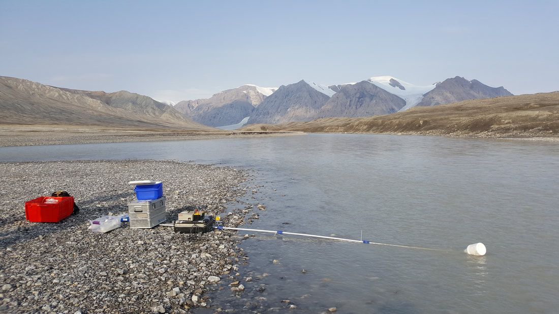
Figure 2.1. Sampling for biogeochemical properties in river water of the Canadian Arctic Archipelago.
2.2 Central BC Coast continuous NCP observations
Dr. W. Evans, lead PI of the Hakai Institute's Ocean Acidification Program, runs a TCO2 "Burk-o-Lator" and autonomous nutrient analyzer at Hakai's Quadra Island field site. In June 2018, I installed a PIGI (Optode / GTD) system alongside the existing instrumentation. These systems will be used to assess net community production on the central coast, over seasonal cycles.
This work is on-going. Please stay tuned for more information.
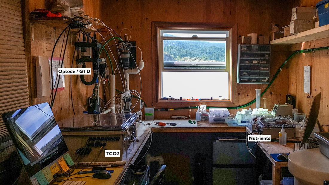
Figure 2.2. The PIGI system setup with the Haki Institute’s TCO2 “Burk-O-Lator” and nutrient autoanalyzer.
